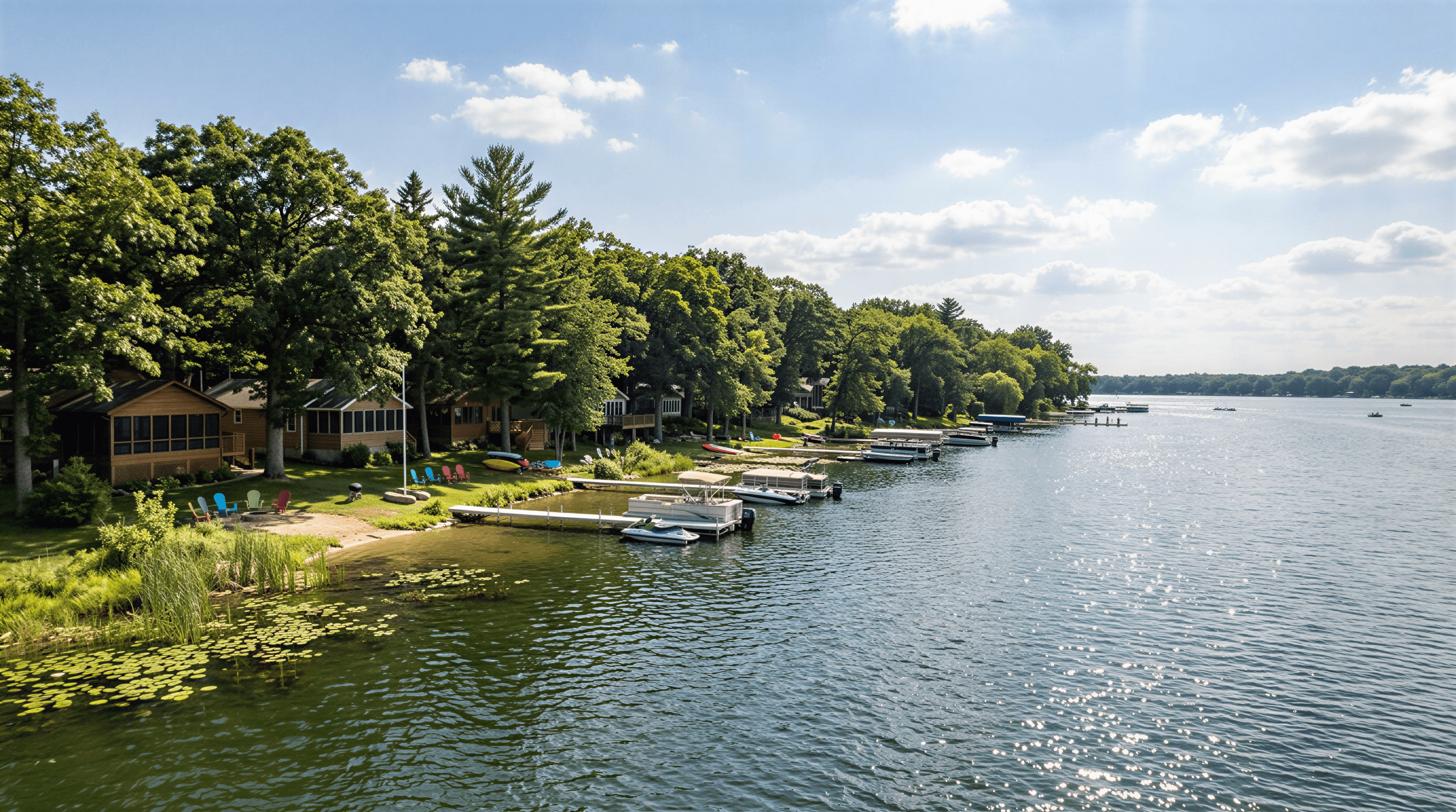

A listing photo shows a pier with two boats on lifts and a swim raft off the end. That photo does not tell you whether any of it is legal, transferable, or replaceable.
The Wisconsin pier permit question on Geneva Lake is really three questions stacked on each other: what the state allows, what Walworth County allows on the land behind it, and what your town allows in the water in front of it. Get one layer wrong and you are looking at a removal order, a doubled permit fee, or a closing that stalls three weeks before it should.
By the end of this guide you will know which pier designs need no permit at all, what changed in Wisconsin's pier code on April 1, 2026, the Geneva Lake rules that exist on no other Wisconsin lake, and what the process costs and takes.
The Three-Layer Rule Stack
The Wisconsin DNR governs everything below the ordinary high water mark: the pier, lifts, shelters, and rafts. Walworth County governs the land within 1,000 feet of shore through shoreland zoning. Your town, village, or city governs the pier itself through a local permit and a pierhead line. Clearing one layer does not clear the others.
That is where owners get hurt. A pier can be fully exempt from state permitting and still be illegal because it sits 8 feet from the neighbor's riparian line instead of 12.5. The DNR will never tell you that. Your town will, usually after the pier is in the water.
New to riparian rights and slip ownership? Start with our breakdown of Lake Geneva riparian rights, piers, slips, and water access, then come back for the permitting mechanics.
When You Need a Wisconsin Pier Permit, and When You Do Not
Most residential piers in Wisconsin never need a state permit. They qualify for an exemption, which means you design to the standard and place the pier without contacting the DNR at all.
The exempt pier checklist
Per the DNR Pier Planner updated in April 2026, a new pier is exempt when it meets all of these:
- Six feet is the hard ceiling on width. No portion, including catwalks, finger piers, or the arms of an L or T.
- The loading platform caps at 200 square feet. This is the flat gathering area at the end, and it is the number most custom designs blow past.
- Length is set by depth, not preference. A pier may run to the 3-foot water depth at summer low levels, to a depth adequate for mooring or a lift, or to an approved municipal pierhead line, whichever is farthest from shore.
- It must float or sit on piles or posts. Solid piers on fill and piers on rock-filled cribs require an individual permit and are authorized only in narrow circumstances.
- Only the riparian owner may place it. A contractor can build it, but the waterfront owner carries the compliance responsibility.
- It cannot block water movement or trap sediment and plants.
Miss one and the project moves to an individual permit application.
How many boat slips your frontage allows
Slip count is arithmetic. The state allows two boat slips for the first 50 feet of shoreline you own, plus one more for each additional full 50 feet. A slip counts every watercraft docked at the pier, including boats on a lift. Personal watercraft get a separate allowance on the same formula.
So 100 feet of frontage gets three slips. A 140-foot lot also gets three, because the last 40 feet is not a full increment. This is why frontage width, not lot acreage, drives waterfront value here.
Legacy piers and the April 17, 2012 line
This is the most valuable thing a Geneva Lake buyer can understand. The DNR treats any pier first placed in the water before April 17, 2012 as exempt from state approval, and that legacy pier may keep the same slip count it has always had, even where that exceeds current frontage rules.
Seasonal removal does not break legacy status, as long as the pier returns in substantially the same form and location. Expanding it does. Add a slip, widen the platform, extend the length, and the whole structure gets re-evaluated under current standards. Owners lose grandfathered slip counts this way every year.
What Changed on April 1, 2026
For four decades, Wisconsin's pier rules lived in Chapter NR 326. As of April 1, 2026, they live in Chapter NR 320, created under rule order CR 24-051 and published in the January 2026 register. The new chapter consolidates piers, boat shelters, swimming rafts, shore erosion structures, and bridge and culvert placement into one framework.
Older contractor bids, town handouts, and HOA documents still cite NR 326, and some underlying numbers moved. Seasonal boat shelters are now sized at up to 14 feet by 30 feet under the current Pier Planner, where older guidance listed 12 by 24 and 14 by 24 limits tied to lake size. If a document you are relying on cites NR 326, verify it before you build to it.
Geneva Lake Pier Rules That Exist Nowhere Else in Wisconsin
Geneva Lake covers 5,401 acres with a maximum depth of 135 feet, ringed by four municipalities that coordinated their pier law decades ago. State exemption standards are the floor. Local rules are stricter, and they are the ones enforced.
Under the Town of Linn boating code, which sets out the jointly established Geneva Lake standards shared with Fontana-on-Geneva Lake, the City of Lake Geneva, and Williams Bay:
The pierhead line is 100 feet. No pier extends more than 100 feet waterward of the shoreline, and that shoreline is not wherever the water sits today. It is fixed at elevation 864.3 feet above mean sea level, the spillway crest of the Geneva Lake dam.
You must stay 12.5 feet off the riparian line. No pier, wharf, slip, swim raft, or attached structure may sit within 12.5 feet of a neighbor's property line at the shoreline or extended waterward. Structures predating the ordinance are excused, but only if never extended.
A local pier permit is required before placement. The application goes to the municipal clerk with the property description, pier location relative to shoreline and pierhead line, distances to abutting riparian lines, dimensions, and materials. The building inspector reports, then the governing body votes.
Town of Linn now requires an as-built survey. Under a December 2024 amendment, a certified surveyor's as-built survey plus a completion photograph must reach the building inspector within 90 days, showing pier length, width, and riparian setbacks. Miss it and you face a forfeiture. This is the newest compliance trap on the lake.
In the City of Lake Geneva, a pier is a special use. A pier or wharf permit application is routed to the Plan Commission for approval before the permit issues. That is a meeting calendar, not a counter transaction.
Wisconsin Shoreland Zoning Setbacks: The 75-Foot Line and the 35-Foot Buffer
The Wisconsin shoreland zoning setback is where pier projects quietly become house projects. Walworth County's shoreland code covers all unincorporated land within 1,000 feet of the ordinary high water mark of a lake, pond, or flowage.
The statewide minimums under Chapter NR 115 that counties must meet or exceed:
- 75-foot structural setback from the ordinary high water mark. Where an existing development pattern exists, it can be averaged against the two adjacent lots, but never reduced below 35 feet.
- 35-foot vegetative buffer inland from the ordinary high water mark, where vegetation removal is restricted outside approved access and viewing corridors.
- 35-foot height limit on anything within 75 feet of the ordinary high water mark.
Walworth County layers impervious surface standards on top, applied within 300 feet of the ordinary high water mark. Fifteen percent is the baseline cap. Above 15 and up to 30 percent requires a county permit plus an implemented mitigation plan. A DNR-approved highly developed shoreline allows up to 30 percent residential or 40 percent commercial.
Impervious surface counts more than owners expect: homes, garages, sheds, decks, patios, driveways, sidewalks, stairways, retaining walls, and firepits. A patio expansion and a new pier are separate permits from separate agencies, and the patio is usually the harder one.
Two access details are worth memorizing. Stairways and walkways needed to reach the shore are exempt from the shore yard setback, but may be no more than 60 inches wide, with no canopies, roofs, or closed walls, and landings only where safety requires and never over 25 square feet. A structure crossing the Geneva Lake pedestrian easement, the historic shore path, is capped at 36 inches wide.
Before making an offer, walk the shoreline against our Lake Geneva waterfront home inspection checklist. Half the expensive surprises on this lake are visible from the pier if you know what to look for.
Boathouses, Lifts, Shelters, Rafts, and Buoys
Boat lifts and hoists. Exempt if they meet code standards, and they may stay in the water year round.
Seasonal boat shelters. Exempt at up to 14 by 30 feet. Roof or canopy allowed, no sides or walls, and the entire shelter including supports must come out between December 1 and April 1.
Permanent boat shelters. Require a DNR permit, and are not allowed on lakes under 500 acres.
Boathouses over water. New construction waterward of the ordinary high water mark is prohibited. Pre-1979 structures may remain, but repairs are restricted and require DNR approval. Walworth County allows boathouses that are not wet boathouses, limited to watercraft storage, with no habitation or commercial use.
Swim rafts. No permit within 200 feet of shore if no larger than 200 square feet and no taller than 38 inches, or if removed nightly. The 12.5-foot riparian setback still applies.
Mooring buoys. Permitted by the town within 200 feet of the ordinary high water mark. Beyond that, the town acts first and the DNR must approve. All buoys come out by the first day of winter.
How to Get a Pier Approved on Geneva Lake: 7 Steps
- Confirm frontage and riparian lines. Pull the plat of survey and measure frontage at the shoreline, not the road. On curved shorelines, the coterminous method applies rather than simple lot line extension.
- Run the design against the exemption checklist. Six feet wide maximum, 200 square feet of platform maximum, length to the 3-foot depth or the 100-foot pierhead line. Clear all of it and you skip state permitting entirely.
- Order an ordinary high water mark determination if the shoreline is ambiguous. The DNR charges $200 for an OHWM determination and $100 for a confirmation. On eroded or heavily landscaped shorelines, this is the cheapest insurance available.
- Apply for the municipal pier permit first. Budget a full meeting cycle, and in the City of Lake Geneva budget for Plan Commission scheduling. Bring the survey, dimensioned drawings, materials list, and distances to both neighboring riparian lines.
- File with the DNR only if you need to. General permits run $350, individual permits $750, and dredging or marina work $900, through the DNR Water ePermitting System with a MyWisconsin ID.
- Build the timeline backward from ice-out. For an individual permit, the DNR has 30 days to review for completeness, 45 days for public comment, and 30 more if a hearing is requested. Total review typically runs 105 to 135 days. A pier you want in by Memorial Day needs its application filed no later than January.
- Close out the file. In the Town of Linn, get the as-built survey and photograph to the building inspector within 90 days. Keep the permit, survey, and photos with your closing documents. They are the proof of legality the next buyer's agent will ask for.
One warning worth its own line: after-the-fact applications require twice the usual fee, and projects built without the right permits are subject to forfeitures, mandatory abatement, and mandatory restoration.
Pros and Cons of Buying a Property With a Legacy Pier
Pros
- Slip counts that cannot be replicated. A pre-2012 pier can lawfully keep more slips than current frontage rules would grant a new build.
- No state permitting exposure. The legacy exemption removes the DNR entirely unless you change the structure.
- Faster closings. No open application means no contingency waiting on a municipal meeting calendar.
- A footprint already proven against decades of neighbors, water levels, and inspections.
Cons
- Fragile status. One expansion and the grandfathering evaporates. Replacement in kind is safe; improvement is not.
- Thin documentation. Many legacy piers have no permit file, survey, or photo record, and proving the pre-2012 placement date can be genuinely difficult.
- Aging structure, current standards. An old crib or solid pier may not be replaceable in kind if it fails.
- Setback conflicts age badly. A pier 8 feet off the riparian line is fine until a neighbor challenges it or you expand.
- Boathouse risk rides along. Pre-1979 over-water boathouses often accompany legacy piers, with far tighter repair rules than owners expect.
Two Situations, Worked Through
Consider a buyer relocating from Chicago who falls for a 90-foot-frontage property in the Town of Linn with a pier carrying two boats and a lift. She assumes 90 feet buys three slips. It does not. Ninety feet is one full 50-foot increment plus 40 feet, so the formula yields two. The third slip exists only because the pier predates April 2012. Widening the platform for entertaining would trigger re-evaluation and cost her that slip. The right move is to leave the pier alone, verify the pre-2012 date in writing during due diligence, and put the entertaining space on shore within the impervious cap.
Now consider a seller in the City of Lake Geneva planning a spring listing who wants a new pier for the photographs. He starts calling contractors in March. The problem is sequencing, not money. His application is a special use requiring Plan Commission approval, and if the design exceeds exemption standards, DNR review alone typically runs 105 to 135 days. A pier ordered in March is a July pier. The better play is to list with the existing pier, document its compliance, and price the slip capacity.
Why This Matters to Value
Waterfront pricing here is built on frontage width, slip capacity, and legal certainty, in that order. The Wisconsin REALTORS Association reported that Southeast Wisconsin home prices rose 10 percent year over year in January 2026 while inventory stayed tight and the 30-year fixed mortgage rate fell from 6.96 to 6.10 percent. In a market that competitive, a documented pier with a verified slip count is a pricing advantage. An undocumented one is a negotiating lever for the other side.
Frequently Asked Questions
Do I need a Wisconsin pier permit for a residential pier?
Usually not from the state. If your pier is no more than 6 feet wide, has a loading platform under 200 square feet, extends only to the 3-foot depth or an approved pierhead line, floats or sits on piles, and stays within your slip allowance, it is exempt from DNR permitting. You will still need a local pier permit from your Geneva Lake municipality.
How far can a pier extend into Geneva Lake?
One hundred feet. The four Geneva Lake municipalities established a pierhead line 100 feet waterward of the shoreline, with the shoreline fixed at elevation 864.3 feet above mean sea level, the spillway crest of the Geneva Lake dam. State standards would otherwise allow extension to a 3-foot water depth, but the local pierhead line controls.
How many boat slips can I have on Geneva Lake?
Two slips for your first 50 feet of shoreline frontage, plus one more for each additional full 50 feet. Personal watercraft are counted separately on the same formula. Piers first placed before April 17, 2012 may keep their existing slip count even where it exceeds what this formula would allow today.
What is the Wisconsin shoreland zoning setback?
Seventy-five feet from the ordinary high water mark to the nearest part of any building or structure, under the statewide minimums in Chapter NR 115. Where an existing development pattern exists, the setback for a proposed principal structure may be averaged against the two adjacent lots but never reduced below 35 feet. A 35-foot vegetative buffer and a 35-foot height limit also apply.
Can I replace an old pier without losing its grandfathered status?
Yes, if you replace it in substantially the same form and location. Seasonal removal and reinstallation does not affect legacy status. Extending the length, widening any portion, or adding slips does, and the entire structure is then evaluated against current standards.
The Bottom Line
A Wisconsin pier permit is rarely the hard part. The hard part is knowing which of the three rule layers applies to your project, and confirming what your property is already legally entitled to before you change anything.
Frontage sets slip count. The pierhead line sets length. The 12.5-foot riparian setback sets position. The 75-foot shoreland setback and Walworth County's impervious caps govern what you build on shore. And the April 17, 2012 legacy date determines whether the pier you are looking at is an asset you can keep or a structure you are about to reset to current standards.
If you are buying, selling, or planning a shoreline project on Geneva Lake, get in touch with Legendary Real Estate Services. We will help you verify what your frontage supports, what the existing structures are entitled to, and how that translates into price before you are under contract.

About Jade Goodhue
Expert real estate agent specializing in Lake Geneva and surrounding areas. Helping families find their dream homes with personalized service and local market expertise.
Contact Jade Goodhue